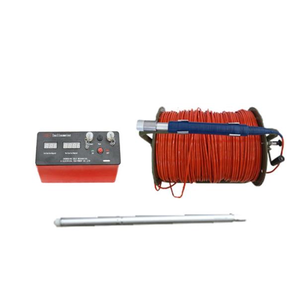
Borehole inspection inclinometer JQX-2 digital inclinometer for sale
JQX-2 lightweight digital inclinometer is a professional instrument that plays an important role in the field of geological engineering. It is mainly composed of a complete inclinometer system consisting of a ground instrument, a downhole probe, a lightweight manual winch, and cables.
It has a wide range of uses and can be used for the measurement of various non-magnetic or weakly magnetic geological boreholes. Whether it is in geological exploration for mineral resources, or in the precise monitoring of boreholes in water conservancy and hydropower projects, geotechnical engineering and other projects, it can show its prowess.
It performs well in terms of measurement range and accuracy. The vertex angle range is 0 to 60°, and the accuracy can reach ≤0.1°; the azimuth range is 0 to 360°, when the vertex angle is ≥3°, the azimuth accuracy is ±4°, and when 2°≤vertex angle≤3°, the azimuth accuracy is ±6°. It has strong adaptability to the working environment, and the working temperature is between 0 and 85℃, and it can operate normally in a variety of complex environments. The probe can be lowered to a depth of 1,000 meters, which is sufficient to meet most geological drilling measurement needs.
It is extremely easy to operate and can be easily used by staff. It can directly read the top angle and azimuth, and has a digital display function, which can be used for both point measurement and continuous measurement. The overall design is lightweight and easy to carry, and can be easily transported and used in mountainous areas or other field work sites. Its high-precision measurement results provide reliable data support for geological research, engineering construction, etc., effectively ensuring the smooth progress and accurate decision-making of related projects, and is an indispensable and effective tool in the field of geological exploration.
It consists of ground instrument, downhole probe, light manual winch and other related accessories.
1. Preparation: Check whether all parts of the instrument are intact, including the surface instrument, downhole probe, manual winch, cable, etc., and ensure that the battery is fully charged.
2. Instrument connection: Connect one end of the cable to the downhole probe and the other end to the surface instrument to ensure that the connection is firm.
3. Calibration operation: Calibration is required before use. According to the requirements of the instrument manual, place the probe on the calibration table at a known angle and adjust the instrument parameters to make the measurement results consistent with the known angle.
4. Downhole measurement: Slowly place the probe into the borehole and control the lowering speed and depth by manual winch. After reaching the predetermined depth, stay for a while, wait for the instrument to stabilize, and read the vertex and azimuth data.
5. Measurement record: Record the depth, vertex and azimuth data of each measurement. You can choose point measurement or continuous measurement as needed.
6. Measurement completion: After the measurement is completed, slowly lift the probe out of the borehole, turn off the power of the instrument, disassemble all components and keep them properly.