Specifications
Brand Name :
Hi-target
Model Number :
iRTK5X
Place of Origin :
China
MOQ :
1 piece
Price :
$2,800.00
Payment Terms :
L/C, T/T
Supply Ability :
1 ~ 30 day
Delivery Time :
30 work day
Product name :
RTK receiver Hi-target iRTK5X
Material :
magnesium alloy
Internal battery life :
Static 12hours
Channels :
1408
GPS :
L1,L2,L5
GLONASS :
L1,L2
QZSS :
L1,L2,L5
GALILEOS :
E1,E5a,E5b
Description

GNSS RTK Hi -target IRTK5X Upgrade for Land Surveying Instruments Survey IMU GPS

Overview
Products Description
RTK iRTK5X technical parameters
GNSS configuration
Number of channels: 1408
BDS: B1I, B2I, B3I, B1C, B2a
GPS: L1, L2, L5
GLONASS: L1, L2
GALILIEO: E1, E5a, E5b
SBAS: Support
QZSS: L1, L2, L5
Output format
ASCII: NMEA-0183, binary code
Positioning output frequency
1Hz~20Hz
Static data format
GNS, Rinex dual format static data
Difference format
CMR, RTCM2.X, RTCM3.0, RTCM3.2
Network mode
VRS, FKP, MAC; support NTRIP protocol
System Configuration
operating system
Linux operating system
Start Time
3 seconds
data storage
Built-in 16GB ROM, supports automatic storage of static data
Accuracy and reliability [1]
RTK positioning accuracy
Plane: ±(8+1×10⁻⁶D) mm (D is the distance between the measured points)
Elevation: ±(15+1×10⁻⁶D) mm (D is the distance between the measured points)
Static positioning accuracy
Plane: ±(2.5+0.5×10⁻⁶D) mm (D is the distance between the measured points)
Elevation: ±(5+0.5×10⁻⁶D) mm (D is the distance between the measured points)
DGPS positioning accuracy
Plane accuracy: ±0.25m+1ppm; elevation accuracy: ±0.50m+1ppm
SBAS positioning accuracy
0.5m
Initialization time
<10 seconds
Initialization reliability
>99.99%
Communication unit
I/O port
USB interface, SMA interface
Built-in 4G network communication
Built-in eSIM4 card, including 3 years Internet access fee, you can connect to the Internet after power on
WiFi communication
802.11 a/b/g/n access point and client mode, can provide WiFi hotspot service
blue tooth communication
blue tooth® 4.0/2.1+EDR, 2.4GHz
Built-in radio
Built-in transceiver station:
Power: 1W/2W/4W adjustable
Frequency band: 403MHz~473MHz
Protocol: HI-TARGET, TRIMTALK450S, TRIMMARKⅢ, TRANSEOT, SOUTH, CHC, SATEL
Number of channels: 116 (16 of which can be configured)
sensor
Electronic bubble
Realize smart alignment
Tilt measurement
Built-in high-precision inertial navigation, automatic attitude compensation, 8mm+0.7mm/°tilt (accuracy within 30°<2.5cm)
User Interface
button
A power button
LED indicator light
Satellite lights, signal lights, power lights
WEB UI
Built-in WEB page to realize receiver setting and status check
Function application
Advanced Features
OTG function, NFC IGRS, WebUI interaction, U disk firmware upgrade
Smart application
Smart base station, smart voice, function self-check, smart CORS
Remote Service
News push, online upgrade, remote control
cloud service
Equipment management, location services, collaborative operations, data analysis
Physical characteristics
Host battery
Built-in high-capacity lithium battery 6800mAh/7.4V, network mobile station working time is more than 10 hours[2]
External power supply
Support USB port charging and external power supply
size
Φ158mmx78mm
weight
≤1.3kg
Power consumption
4.2W
material
The shell is made of magnesium alloy material
Environmental characteristics
Dustproof and waterproof
IP68
Anti-fall
Resistance to natural drop of 2m high measuring rod
Relative humidity
100% non-condensing
Operating temperature
-45℃~+75℃
storage temperature
-55℃~+85℃
Why Choose Us
GEODETSKOJ ŠKOLI SPLIT isporučujemo STONEX totalne stanice, teodolite i GNSS prijemnike
Geodetske škole imaju ključnu ulogu u pružanju učenicima potrebnog znanja i vještina u području geodezije.Integracija najnovijih
geodetskih instrumenata u takve obrazovne ustanové može značajno poboljšati iskustvo učenika i bolje ih pripremiti za primjenu u
stvarnom svijetu.Najnoviji geodetski instrumenti nude napredne značajke i mogućnosti koje mogu pružiti studentima intenzivnije
iskustvo učenja.Korištenjem ovih instrumenata, studenti mogu steći praktično iskustvo u prikupljanju podataka, analizi itumačenju, što su ključne vještine u području geodezije.
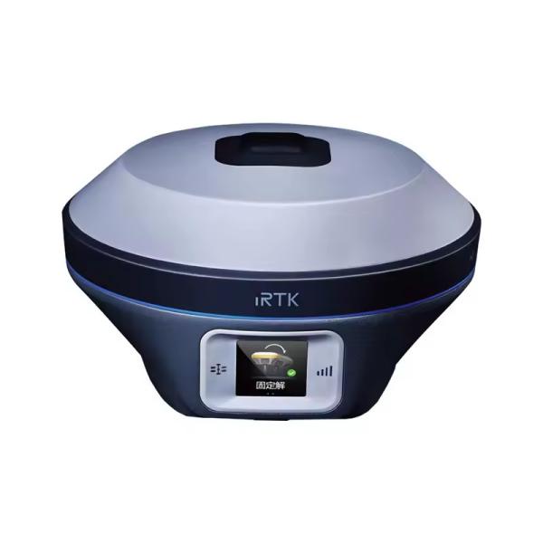
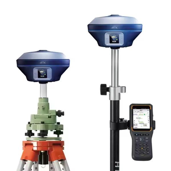
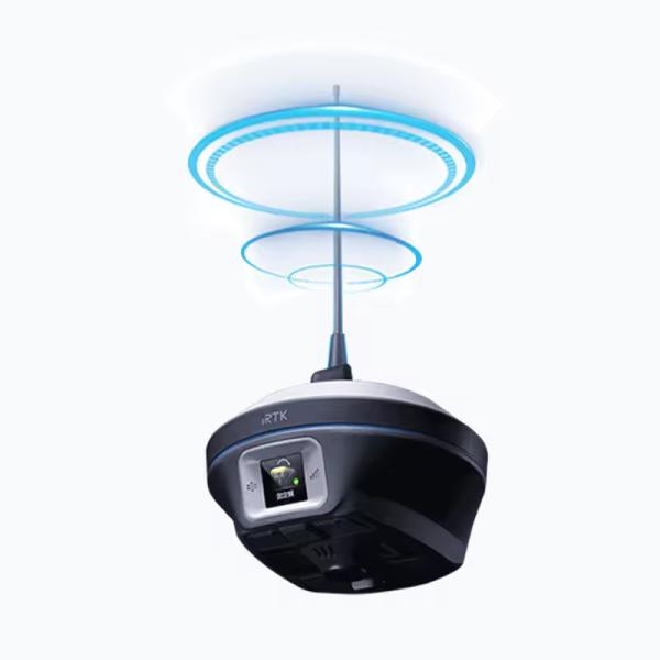
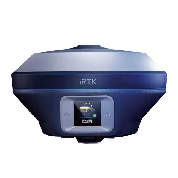
U suradnji sa STONEX S.r.l. Italija, geodetskoj školi u Splitu isporučili smo najnovije totalne stanice, teodolite i GNSS prijemnike.
Customer Photos
Certifications
Company Profile

FAQ

1. who are we?
We are based in sichuan, China, start from 2016,sell to Africa(30.00%),Southeast Asia(16.00%),Mid East(11.00%),Eastern
Asia(10.00%),South America(10.00%),Central America(5.00%),South Asia(5.00%),Southern Europe(5.00%),North America(4.00%),Eastern
Europe(4.00%). There are total about 11-20 people in our office.

2. how can we guarantee quality?
Always a pre-production sample before mass production;
Always final Inspection before shipment;

3.what can you buy from us?
GNSS RTK,Total station,Level,Survey accessory,laser rangefinder

4. why should you buy from us not from other suppliers?
1.More than 20 years of experience in the trade field. 2.All products will have been strictly quality checked in factory before
sending out and all products have one year warranty.

5. what services can we provide?
Accepted Delivery Terms: FOB,CFR,CIF,EXW,FAS,CIP,FCA,CPT,DEQ,DDP,DDU,Express Delivery,DAF,DES;
Accepted Payment Currency:USD,EUR,JPY,CAD,AUD,HKD,GBP,CNY,CHF;
Accepted Payment Type: T/T,L/C,D/P D/A,MoneyGram,Credit Card,PayPal,Western Union,Cash,Escrow;
Language Spoken:English,Chinese,Spanish,Japanese,Portuguese,German,Arabic,French,Russian,Korean,Hindi,Italian

Our Service
Packing & Delivery
Send your message to this supplier
Send Now

GNSS RTK Hi -Target IRTK5X Upgrade For Land Surveying Instruments Survey IMU GPS

Ask Latest Price
Brand Name :
Hi-target
Model Number :
iRTK5X
Place of Origin :
China
MOQ :
1 piece
Price :
$2,800.00
Payment Terms :
L/C, T/T
Contact Supplier
GNSS RTK Hi -Target IRTK5X  Upgrade For Land Surveying Instruments Survey IMU GPS

Chengdu Jiebo Technology Co., Ltd.

Verified Supplier
1 Years
sichuan, chengdu
Since 2016
Business Type :
Trading Company
Total Annual :
150000.00-200000.00
Employee Number :
50~100
Certification Level :
Verified Supplier
Contact Supplier
Submit Requirement